
香港海事博物館大型航海圖冊《針路藍縷》(香港中華書局2015年11月13日出版,香港海事博物館2016年1月28日舉行首發式)
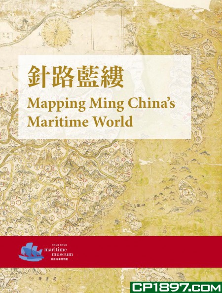
《針路藍縷》 MAPPING MING CHINA’S MARITIME WORLD
《針路藍縷》套裝包括兩冊書和一張按《明代東西洋航海圖》原圖印製的大地圖,乃2014年香港海事博物館舉辦特別展覽及學術會議的成果之作。2014年3月21日至6月23日期間,香港海事博物館與英國牛津大學的博德利圖書館和阿什莫爾博物館合作,舉辦《針路藍縷:牛津大學珍藏明代海圖及外銷瓷》特展。同年6月7日至8日於博物館舉行《明代海洋貿易、航海術和水下考古研究新進展》國際學術會議。本套書一冊是展覽圖錄,一冊是學術會議中發表的十九篇論文彙編。
盒裝兩冊,軟皮精裝,彩色印製, 2015 ISBN: 978-988-8366-56-9 文字: 中、英文 零售價: HK$580.00 . 內容包括:
1、 展覽圖錄: 《針路藍縷─牛津大學珍藏明代海圖及外銷瓷》, 296 頁
2、論文集:《明代海洋貿易、航海 術和水下考古研究新進展─香港海事博物館國際會議論文集》, 512 頁
2-volumes box set, Softback, Full colour, 2015 ISBN: 978-988-8366-56-9 Language: Chinese and English Retail price: HK$580.00 Catalogue: Mapping Ming China’s Maritime World : the Selden Map and Other Treasures from the University of Oxford, 296 p. Proceedings: New Research into the Maritime Trades, Seafaring and Underwater Archaeology of the Ming Dynasty: Hong Kong Maritime Museum International Symposium Proceedings, 512 p.
策展人和總編輯:焦天龍
編輯:陳佳榮,Tom Christensen, 馮錦榮
編輯助理:畢宛清,袁康翹
編輯委員會:譚廣濂,錢江,王式中
[Curator of the Exhibiting & Chief Editor: Tianlong Jiao
Editors: Chen Jiarong, Tom Christensen, Fung Kam Wing
Editorial Assistant: Kitty But, Kenny Yuen
Editorial Board: Tam Kwong alim, Qian Jiang, William Waung]
責任編輯:黎耀強,賴菊英
裝幀設計:高林
排版:時潔
印務:劉漢舉
《針路藍縷─牛津大學珍藏明代海圖及外銷瓷》
目 錄 Contents
前言 董建成 / 6
Foreword C. C. Tung
序言 Richard Ovenden / 8
Preface
引言 焦天龍 / 12
Introduction Tianlong Jiao
圖版及說明 Catalogue and plates
《明代東西洋航海圖》及其他海圖 / 18
The Selden Map of China and Other Navigation Chart
《明代東西洋航海圖》 / 24
The Selden Map
《皇明一統方輿備覽》 / 26
Huang Ming yitong fangyu bei lan (Map of Ming China)
《鄭和航海圖》 / 28
Zheng He hanghai tu (Zheng He Navigation Chart)
《坤輿萬國全圖》 / 30
Kunyu wanguo quantu (Complete Map of All Nations on Earth)
《巴爾托洛梅烏‧維利烏海圖》 / 34
Baertuo luomeiwu weiliwu hai tu (Bartolomeu Velho’s Chart)
《大明九邊萬國人跡路程全圖》 / 36
Da Ming jiubian wanguo renji lucheng quantu (General Map of Ming dynasty China and All the Surrounding Countries)
《東西洋考》刻印本 / 38
Dongxiyang kao (Study of the East and West Seas) printed book
明代外銷瓷 / 42
Export porcelain in the Ming dynasty
《順風相送》與《指南正法》 / 58
Shunfeng xiangsong and Zhinan zhengfa
《順風相送》海道針經手抄本 / 62
Shunfeng xiangsong (Favourable Winds in Escort) manuscript
《指南正法》海道針經手抄本 / 186
Zhinan zhengfa (The True Art of Pointing South) manuscript
《明代海洋貿易、航海 術和水下考古研究新進展─香港 海事博物館國際會議論文集》
目 錄
第一部 明代東西洋航海圖
《明代東西洋航海圖》與明末福建人的海外貿易 / 2 錢江 香港大學
從《明代東西洋航海圖》看東亞群島 / 22 貝瑞葆 美國南佐治亞大學
十六世紀末至十七世紀初東亞海圖繪製史的一些看法: 以《明代東西洋航海圖》與《中華帝國及其周邊王國及島嶼》為中心 / 64 馮錦榮 香港大學
第二部 明代針經
明代的海路、海圖及針經 / 90 陳佳榮 香港中華萬年網
《順風相送》與中琉航海 / 109 謝必震 福建師範大學
《順風相送》研究八十年 / 118 劉義傑 海洋出版社
清代針路簿──《指南正法》中的航海名詞術語系統 / 141 汪前進 中國科學院自然科學史研究所
第三部 明代沉船考古
「南澳 1 號」沉船與明代外銷瓷 / 206 崔勇 廣東省文物考古研究所水下考古中心
從福建明代沉船出水瓷器探討景德鎮瓷器外銷的幾個問題 / 215 羊澤林 福建博物院考古研究所
近來台灣水下考古的發現 / 242 臧振華 台灣中央研究院歷史語言研究所 南海沉船與明代海洋貿易的變遷 / 251 焦天龍 香港海事博物館
第四部 明代航海史
十六世紀葡文資料中的南澳島簡介 / 264 普塔克 德國慕尼黑大學
明代航海的航路和航向定位:可能性與不可能性 / 289 戴偉思 香港大學
第五部 《明代東西洋航海圖》再探
《明代東西洋航海圖》之製圖及其與十七世紀初亞洲絲綢貿易的可能連繫 / 338 譚廣濂 香港海事博物館
《明代東西洋航海圖》在南海史地研究中的價值 / 389 朱鑒秋 上海鄭和研究中心
由分野標記試論《明代東西洋航海圖》之成圖年代 / 403 陳泳昌 香港大學
《明代東西洋航海圖》的保護、修復及其在香港海事博物館的展覽 / 421 羅伯特‧敏特 瑪妮塔‧斯蒂兹 牛津大學博德利圖書館
第六部 明代中國與東南亞
英藏明末閩商航海圖出自廈門灣 / 440 周運中 廈門大學
茅坤圖、《順風相送》、耶魯大學圖書館藏中國航海圖的一些東南亞地名 / 464 韋傑夫 澳洲國立大學
詞彙表 / 495
Contents
Section 1
The Selden Map The Selden Map and the Hokkien maritime trade in late Ming / 2 James K. Chin University of Hong Kong
Viewing the East Asian archipelago through the Selden Map / 22 Robert Batchelor Georgia Southern University
Issues in the history of cartography of East Asia from the late sixteenth century to the early seventeenth century: the Selden Map and Sinarum Regni aliorūq. regnoru et insularū illi adiacentium descripti / 64 Fung Kam Wing University of Hong Kong
Section 2 Seafaring of the Ming dynasty
Ming dynasty sea routes, navigation maps and rutters / 90 Chen Jiarong China10k
Shunfeng xiangsong and the ancient navigations between China and Ryukyu / 109 Xie Bizhen Fujian Normal University
A study of Shunfeng xiangsong over eighty years / 118 Liu Yijie Ocean Press
Navigational guide (Zhenlu bo) of Qing dynasty: the system of terms and terminology of navigation in Zhinan zhengfa / 141 Wang Qianjin The Institute of the History of Natural Sciences, Chinese Academy of Science
Section 3 Archaeology of shipwrecks in the Ming dynasty
Nan’ao No.1 shipwreck and export porcelain of the Ming dynasty / 206 Cui Yong Centre for Underwater Archaeology, Institute of Archaeology of Guangdong Province
On a few questions about the export of Jindezhen wares based on the data of unearthed porcelains from shipwrecks of Ming dynasty in Fujian / 215 Yang Zelin Institute of Archaeology, Fujian Museum
The recent discoveries of underwater archaeology in Taiwan / 242 Tsang Cheng-hwa Academia Sinica, Taiwan
Shipwrecks in South China Sea and the changes of the maritime trade of the Ming empire / 251 Tianlong Jiao Hong Kong Maritime Museum
Section 4 Maritime history of the Ming dynasty
Some Notes on Nan’ao Island in Portuguese Sources of the Sixteenth Century / 264 Roderich Ptak Ludwig-Maximilians-Universitat, Munich
On courses and course keeping in Ming dynasty seafaring: probabilities and improbabilities / 289 Stephen Davies University of Hong Kong
Section 5 The Selden Map Revisited
The Selden Map, its cartography, and its probable link with early seventeenth century Asian silk trade / 338 K. L. Tam Hong Kong Maritime Museum
The value of the Selden Map in the study of South China Sea historical geography / 389 Zhu Jianqiu Zheng He Research Centre, Shanghai
On the composition time of the Selden Map based on a study on its fenye markings / 403 Chan Wing Cheong University of Hong Kong
The conservation of the Selden Map and its display at the Hong Kong Maritime Museum / 421 Robert Minte Marinita Stiglitz Bodleian Libraries, University of Oxford
Section 6 Ming China and Southeast Asia
The author of the Selden Map was from Xiamen Bay / 440 Zhou Yunzhong Xiamen University
Some Southeast Asian place names in the Mao Kun maps, Shunfeng xiangsong and the Yale University Library Chinese navigational map book / 464
Geoffrey Wade Australian National University Glossary / 495